Route
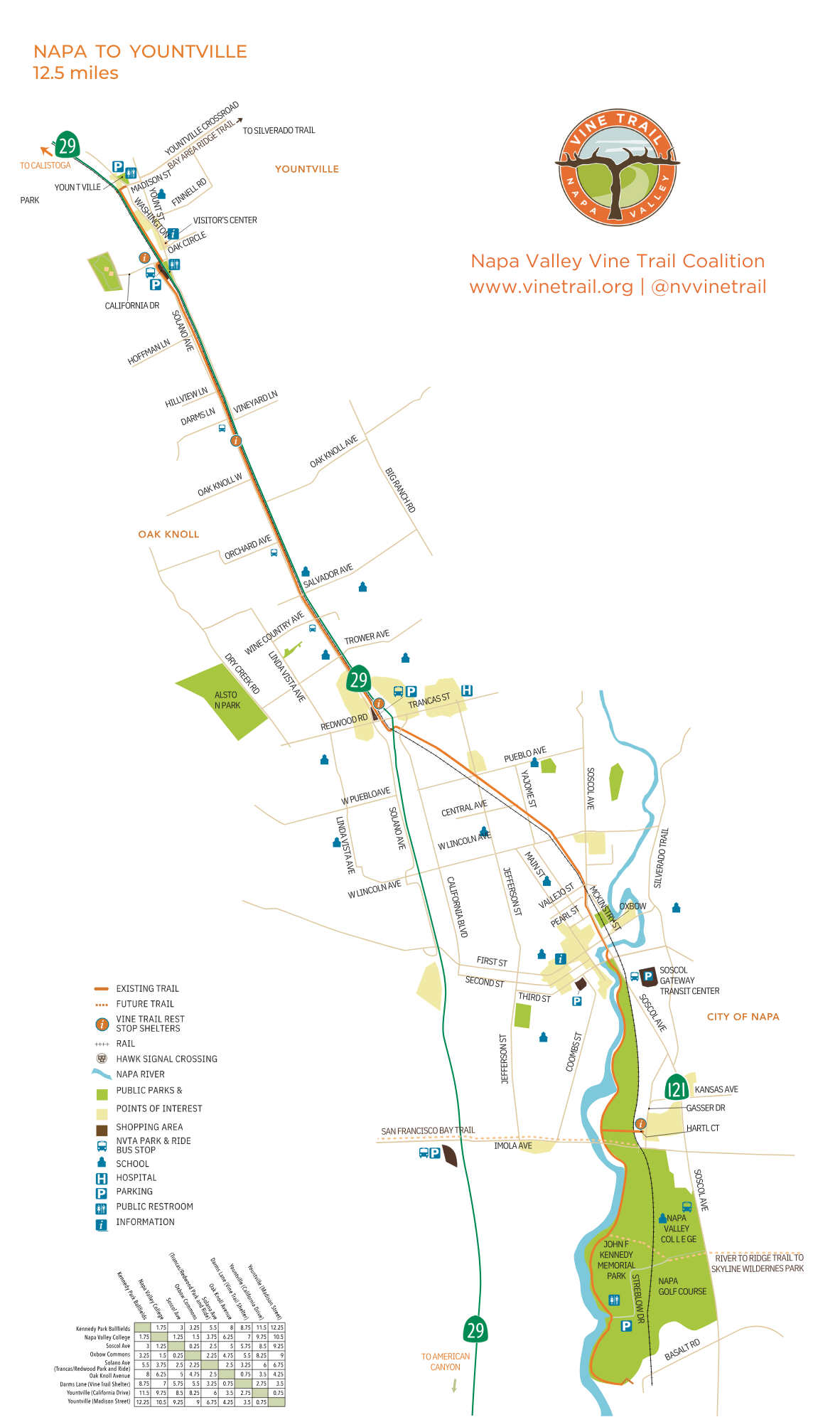
Map of the completed 12.5 miles from Kennedy Park to Yountville.
Download Napa to Yountville Map
VINE TRAIL maps are available for download below, including construction maps.
From the Napa River wetlands to Calistoga's Hot Springs
Beginning near the Ferry Terminal in historic Vallejo (thus linking with the greater Bay Area), the Vine Trail will continue north for 47 miles, through the world-renowned vineyards and towns of Napa Valley, to its northern gateway in Calistoga at the Oat Hill Mine Trail (Hwy29 at Silverado Trail) at the foot of Mount St. Helena.
10 Sections
The Napa Valley is world-famous above all for its vineyards and their appellations. To reflect this unique sense of place, we have organized the Vine Trail route into 10 SECTIONS, each named for the city or vineyard AVA (American Viticultural Area) the trail passes through. From north to south, these are: Calistoga, St. Helena, Rutherford, Oakville, Yountville, Oak Knoll District, City of Napa, Vista Carneros, American Canyon, and Vallejo. The 47-mile Vine Trail route has been mapped and its ten sections are in various stages of design or construction as shown on this map.
Full 47-Mile Vine Trail Route Map
Vallejo to American Canyon 7.5 miles Construction Map
Download Vallejo to American Canyon Map
St. Helena to Calistoga 8.2 miles Construction Map
Download St. Helena to Calistoga Map